
Via Ferrata Weißbach – Nackter Hund
The Klettersteig Nackter Hund is a spectacular via ferrata route set in the rugged limestone terrain of the Loferer Steinberge in Austria. The route offers a compelling mix of steep climbing, exposed ridges, and alpine atmosphere. Though it carries the name of the 2 372 m summit “Nackter Hund,” the climbing mostly traverses its flank and ridge, culminating near the nearby 2 506 m summit of the Mitterhorn. This makes for an unforgettable and demanding mountain experience.
Trail Overview
Location: Weißbach bei Lofer / Loferer Hochtal, Salzburg region, Austria.
Highest point reached via route: ~2 506 m (Mitterhorn) though the true summit of Nackter Hund at ~2 372 m may or may not be reached depending on your chosen line.
Total elevation gain: Approximately 1 600–1 650 m from valley to ridge.
Difficulty rating: C/D on via ferrata scale (with sections up to D) — steep and exposed.
Time required: A long day tour or better as a summit day with early start; approach and descent add substantial time.
Route Description
The approach begins from either Lofer via the Loferer Hochtal road (Weg 601) to the Schmidt Zabierow-Hütte (1 966 m) or from Weißbach via Lastal (Weg 613) to the Wehrgrubenjoch (2 218 m).
At the Wehrgrubenjoch one follows cairns (Steinmännchen) along the South-East ridge of the Nackter Hund or dips into a band on the North-East side to reach the actual via ferrata start.
Climbing sequence:
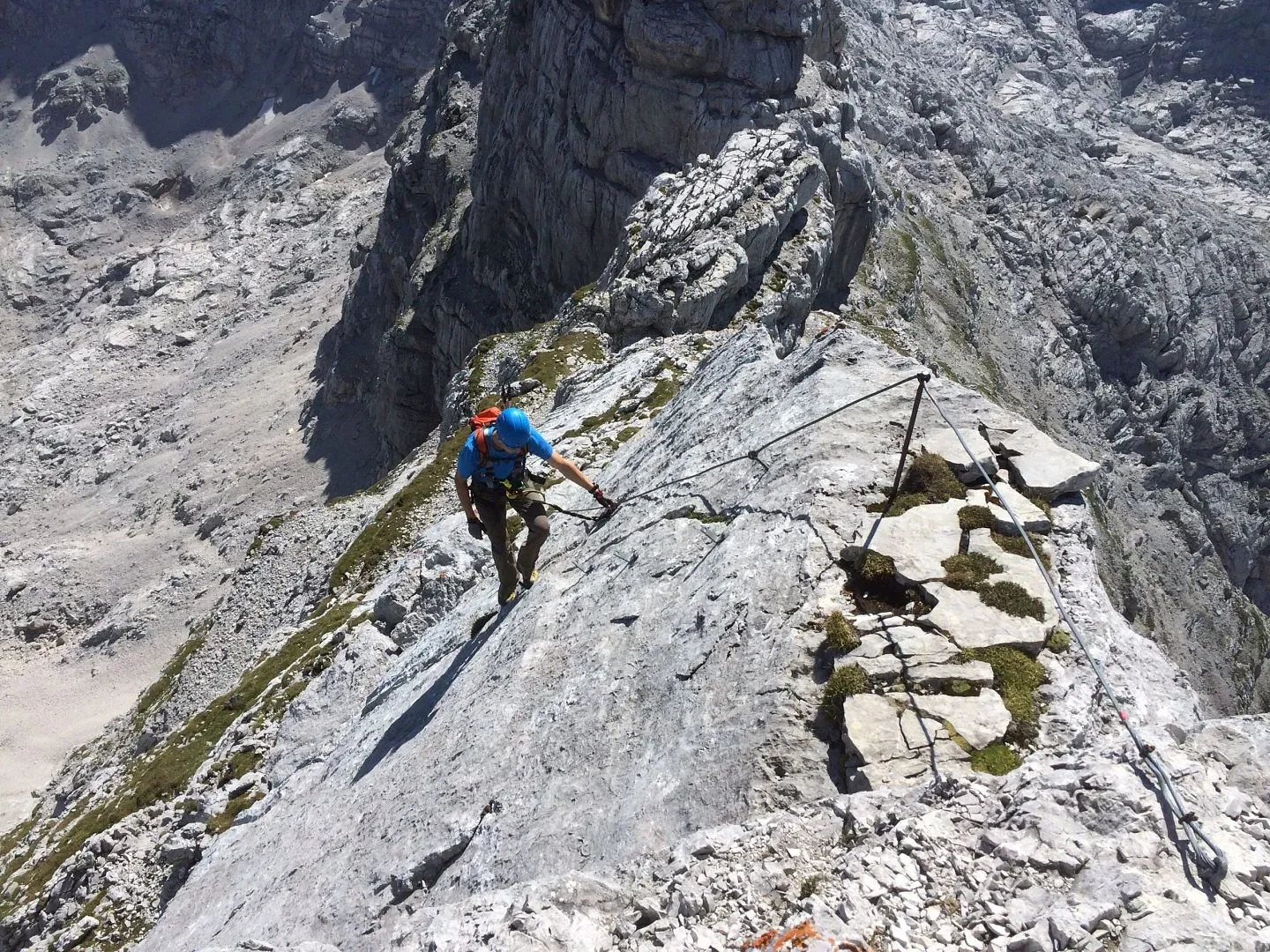
Initial section: a narrow traverse band across the NE face, broken by steeper bits (A/B to C/D) with wonderful exposure and open views.
Middle section: enters a steeper ramp and chimney system (C/D) leading to the notch (scharte) between Nackter Hund and the Mitterhorn.
Final ridge section: climbs the SE ridge of the Mitterhorn via fixed cables and iron steps; there are further C/D segments until the route rejoins the normal trail near the summit area.
Once the cables end, one follows the ridge/walking traverse to the summit cross or nearby summit plateau. Descent is either via the normal path (Weg 612) back to Schmidt-Zabierow-Hütte and onward down to the valley, or via an alternative secured route.
Highlights
Performing a climb across the dramatic limestone ridges of the Loferer Steinberge, with sweeping views into the valleys below.
The exposure and airy traverse sections give the sensation of being high above the world, especially during the band traverse and chimney segments.
The summit area of Mitterhorn provides excellent panoramic views of surrounding peaks and valleys — a real alpine reward for the effort.
The combination of hike, via ferrata and ridge traverse offers variety rather than just a fixed climbing line.
Difficulty and Required Skills
This route is for experienced mountaineers/via ferrata enthusiasts, not beginners. The key points:
Via ferrata difficulty reaches D (with sustained C/D sections) — high technical demand, steep walls, exposed positions.
Strong surefootedness, head for heights, and secure movement on exposed terrain are essential.
Good alpine stamina is needed: long approach, significant elevation gain, and full day commitment.
Equipment: helmet, full via ferrata set (energy-absorbing lanyard), gloves, sturdy hiking/approach boots. In early or late season, there may be snow or icy patches — crampons may be wise.
Given the length and exposure, weather must be very stable — thunderstorms or sudden change can turn this into a serious hazard.
When to Go
Best season: Late June through September. By then snow on the route is likely melted, and huts and access roads are open.
Early summer (June) may still have snow on north-facing sections; in this case extra caution or postponement is advised.
Late season (October) may bring colder nights, possible snow or ice, and route may be more hazardous.
Start very early (dawn or early morning) to maximise daylight and avoid afternoon storms.
Access and Logistics
Starting point: Drives or public transport bring you to either Lofer (B 312) or Weißbach bei Lofer. From Lofer, follow the road into the Loferer Hochtal to the end of the valley (parking at the end of the road). From Weißbach/Lastal side via Weg 613.
Hut option: Schmidt-Zabierow-Hütte (1 966 m) is an ideal base; staying overnight reduces fatigue and allows a more relaxed morning start.
Descent options: From summit area, follow Weg 612 or normal route back to valley; ensure maps/GPS track due to rugged terrain.
Transport: By car is typical; region is served by some bus lines but early morning access may require private vehicle.
Supplies: Ensure you carry sufficient water, snacks, as higher sections have no services. Check hut opening times.
Maps & topo guides: AV Karte Nr. 9 Loferer- und Leoganger Steinberge; ÖK 92 Lofer.
Why It Belongs on Every Adventurer’s List
This via ferrata stands out because it delivers the full alpine experience: hike, climb, ridge, exposure, summit, and panorama. It blends technical challenge with mountain grandeur. If you’re seeking a route that goes beyond a simple mountain path and drops you into real alpine terrain, the Nackter Hund offers exactly that. From the dramatic limestone walls of the Loferer Steinberge to the finishing ridge of Mitterhorn, you’ll feel immersed in the wild heart of the Alps. It’s a route that stays in memory long after the descent.